Calculating the design flow, or runoff, is usually one of the most difficult parts of an engineering project. We’ve come a long way towards defining some of the abstractions, but unfortunately it is still an inexact science.
There are three primary methods to calculating a design flow (and one additional important consideration):
- Rational Method
- SCS (NRCS) Curve Number Method
- Station Frequency Analysis
- Other site evidence
Rational Method
This method is widely used because it is easy to understand and get a feel for the result. The formula is:
| U.S. Units | Metric |
|---|---|
| $latex Q = CiA$
Where:
Q = Runoff (ft3/s) C = Runoff Coefficient (table) i = Rainfall intensity (in/hr) A = Drainage area (ha) |
$latex Q = 0.00278CiA$
Where:
Q = Runoff (m3/s) C = Runoff Coefficient (table) i = Rainfall intensity (mm/hr) A = Drainage area (ha) |
Clearly, if you have a constant rainfall intensity over an area, you will have a flow generated by the entire area. The steps to performing a rational method calculation are as follows:
- Find the drainage area. Usually a topographic map or other similar device is sufficient.
- Choose the runoff coefficient. Use a hybrid if necessary.
- Determine the time of concentration of the watershed. This is defined as the time it takes for rainfall from the remotest part of the drainage basin to reach the outflow point in consideration.
- Look up the rainfall intensity corresponding to the time of concentration. Intensity-Duration-Frequency (IDF) curves are the best source.
More detailed information can be found in my article at Culvert Design.
SCS (NRCS) Curve Number Method
This is a more sophisticated method that takes into account soil infiltration and seepage parameters.
| U.S. Units | Metric |
|---|---|
| $latex Q = \frac{(P – 0.2S)^2}{(P+0.8S)}&s=2$ $latex S = \frac{1000}{CN} – 10$ Where:
Q = runoff (ft3/s) P = 24-hour rainfall (in.) S = potential maximum retention after runoff begins (in.) CN = Curve Number
|
$latex Q = 1.39\frac{(P – 0.2S)^2}{(P+0.8S)}&s=2$ $latex S = 25.4(\frac{1000}{CN} – 10)$ Where:
Q = runoff (m3/s) P = 24-hour rainfall (mm) S = potential maximum retention after runoff begins (mm) CN = Curve Number
|
To perform an analysis using this method, complete the following steps:
- Determine the Curve Number. Look it up on this table. Calculate a hybrid if your watershed has separate areas with different characteristics.
- Find the 24-hour rainfall. Ideally you would have some Intensity-Duration-Frequency (IDF) curves to get this information from.
- Calculate.
More information is found in the NRCS TR-55 manual and in the National Engineering Handbook, chapter 10.
Station Frequency Analysis
This method uses rainfall gauge data to extrapolate runoff to a different site. As you can imagine, it’s quite statistical in nature. The process is like this:
- Gather a list of the nearest gauges. Look at the data to ensure that there is a long enough record (greater than 20 years is preferred) and that the drainage area is similar. Ideally you would want to use gauges that have drainage areas no more than about 5 – 10 times the size of yours. Also, it’s more important to use one with similar characteristics within the basin (hills, trees) than one that’s closer.
- Determine the maximum daily discharge for each year, for each gauge. I will break this down further.
- Obtain the report of daily average data (the report where each day of the year has one record – the average of all the readings throughout the day). This is the data that I am used to using for state DOT (Department of Transportation) work. You can also use the instantaneous readings.
- Find the highest day and aggregate it into a spreadsheet or other software.
- You will then have a record of the highest flow of the year for each year the gauge was operational, for each gauge.
- Use regression analysis to determine the return periods of the flows. Using a spreadsheet the process is like this:
- Enter the flows in column A and sort from lowest to highest.
- Enter sequential numbers in column B, i.e. 1, 2, 3…
- In column C, enter A / (B + 1)
- Column D is 1 – C.
- Column E is 1/D. This is the return period.
- Graph column E vs. column A, if you like. I’ve found that you can get a reasonable guess at a 1:25 or 1:50 year return period from 15 years of data, but I wouldn’t go much less than that. Certainly, if you have more data than your design return period, you are going to be pretty accurate.
- Transpose to your site. You can use the following formula which is a simple ratio. The value of n is generally between 0.6 and 0.75.
$latex Q_2 = (A_2 / A_1)^n$
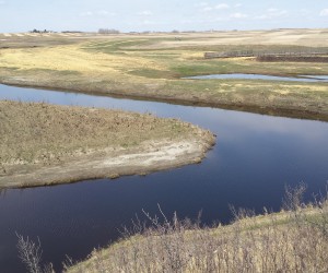
Other Site Evidence
I would be remiss if I didn’t include a section on this, because all of the above methods should be looked at in view of the big picture of evidence at and near the site. Make sure you look at the following factors (This is definitely a non-exhaustive list):
- High water marks at the site. Of course, you have no idea what return period they correspond to, but you probably have some idea how big the flows were in the last year (eg. no significant floods = less than 1:10).
- Bridges and other structures. If you can see any high water marks, or want to know what the maximum flow of the structure is, you can perform a Manning’s equation on the cross-section to get flows. You will just have to estimate the channel slope, but playing with the numbers can be enlightening.
- Try a manning’s equation analysis on the channel cross-section at the site. Chances are you won’t have to design anything substantially larger than the channel, so if you account for some overbank flow you might have all the design flow you need.
- Look into the records. The state DOT, NRCS, or Army Corps of Engineers office might have information of great use to you. The most important information is either:
- historical flood records
- nearby designs (somebody alot smarter than you might have done all your work for you)
- Adjacent streams. I’ve had times where this is a major factor. Try comparing an adjacent drainage area to the size of the stream, as well as culverts, bridges, etc. You’re usually not the first one to look at the area and this can be very enlightening.
Good luck with your runoff problems! Please leave a reply if you have anything to add, so all of us are better off.
Speak Your Mind